Last Update: Thursday, September 02, 2010
Image Gallery

True earthwork & tree removal cross section through single-family residential portion of site, looking southeast. |

True limits of earthwork & tree removal superimposed on developer's representation of same. |
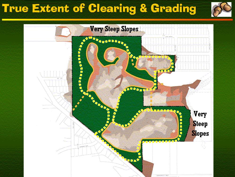
True limits of earthwork & tree removal superimposed on developer's representation of same. |
 COMING ATTRACTIONS: This is a preview of things to come: land clearing stared in June 2008 on an adjacent 7-acre parcel of land (owner by someone else) that will probably see construction of 14+ homes. |

Existing pristine coastal forest |

Superimposed on existing pristine coastal forest (using developer's representation of limits of clearing) |

Existing prime wetlands |

Superimposed on existing prime wetlands |
 Superimposed on habitat inventory & photo points |
Superimposed on existing pristine coastal forest (using developer's representation of limits of clearing) |

Superimposed on existing prime wetlands |
Superimposed on existing prime wetlands |

Existing easterly view today |
True clearing limits |

Developer's plan |

All overlay |


